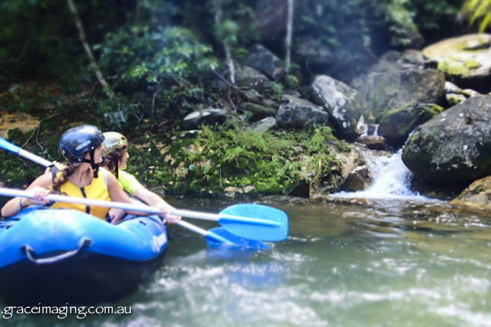
Wildside Adventures
Paddle the Wildside in your own sports raft with Wildside Adventures. The pristine whitewater of Coachable Creek and the mighty Tully River have only been paddled by a few in sports rafts. This is an adventure... You will not Forget !! Your Adventure starts with safety and paddle training.You will realize that your inner Wildside is being released with your first Wahoo !!! as you plunge, splash spin, bounce and jump along natures water paths through stunning pre-historic Rainforest. HALF DAY RAFTING - MORNING OR AFTERNOON ALL DAY RAFTING What to Bring Remember to bring: Change of clothes (wet set/dry set) Plastic bag Towel Baseball cap to fit under your helmet Sunscreen Camera Enclosed footwear or sandals Waiver of liability to be signed before participation Your Go pro (we have mounts on some helmets so make sure you have the correct attachment for your go pro) n.b. Taking your Go Pro or any other device is at your own risk, we will endeavor to provide back up ties etc to secure it, but please make sure your device is insured for rafting. Snacks and Light Lunch Provided All equipment hire: raft, helmet, paddle, life jacket Please contact Wildside Adventures direct to confirm pricing.
Picnic Spots
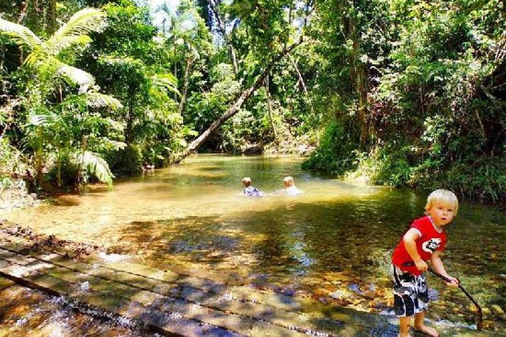
Great Picnic Spots Alligators Nest A beautiful rainforest stream for swimming and picnics. BBQ, picnic and toilet facilities, crystal clear water and magnificent surroundings (6.7 klm from Tully). Turn... right into Tully from the Highway into Butler Street, the main access. The first right again into Murray Street, following the cane train tracks. There are two more right hand turns, and the road is called Murray Street all the way. Continue on this road until you see the sign for ‘Alligators Nest State Forest Park’, where you turn left. From Tully to this point has been 5.8 klm. It is only a further 800 metres to the car park, picnic and beautiful swimming spot. No kiosk and definitely NO crocodiles or alligators! You can either return via the same route into Tully, or at the ‘Alligators Nest State Forest Park’ continue straight ahead. Continue over the Bookal Bookal Creek. “Look Out for Trains Crossing”. Take the first right at the sign saying “Feluga”. Travel past the Feluga School and onto the Feluga Hotel on the corner (5 klm from the Alligators Nest Sign). Follow the road “LOOK OUT FOR TRAINS - DANGER” , over the lines and onto the Highway. You can either travel straight across the Highway and head back towards Mission Beach via the East Feluga Road which is the most direct way, turn right towards Tully and turn at the Mission Beach turn off, or left towards El Arish and take the Mission Beach turn off. Tully Gorge Approximately 44 klm inland from Tully on a sealed road. Drive up Butler Street, turn left at the Post Office into Bryant Street. Drive till you pass the cemetery and brick works, and follow the directions. You travel through banana plantations, cattle grazing country and rainforest. After the road crosses the Tully River, you are entering the Gorge itself, which is an outstanding example of a tropical rainforest gorge. There are excellent views from the sealed road which traverses the Gorge up to Cardstone and the Kareeya Power Station. The Tully River is renowned for white water rafting which operates throughout the year. There are marked viewing areas for watching the white water rafting action, viewing times are approximately 1pm and 2pm daily. At the entrance to the gorge there is a beautiful camping area on the river with BBQ facilities, and safe for swimming. No Kiosk. Murray Falls These falls, among the prettiest in North Queensland with their 30 m drop, spectacular sculptured rocks and crystal clear rock pools can be viewed from an easily accessible platform. Turn from the Highway 18 kilometers south of Tully. It is well sign posted. Travel approximately 22 klms to the camping and picnic area, where you can also enjoy swimming, walking and BBQ facilities. The drive takes you through the Murray Upper region which is a banana and lychee growing area. Paronella Park - Mena Creek Travel north on the Highway towards Innisfail, and turn left from the Highway at Silkwood (7 Klm from El Arish/Mission Beach turn-off). Follow the signs to Japoonvale, (a further 12 klm) through wonderful scenery and this historic sugar growing area. Follow the signs from Japoonvale to Mena Creek (10 klm). The delightful area of Mena Creek is where Jose Paronella fulfilled his dreams building a magnificent Spanish Castle, and planting thousands of trees to establish a romantic garden. Set on 13 acres of rainforest, this is a delightful place to picnic, swim near the falls, feed the ducks and fish, spot turtles, watch the birds and butterflies, take a guided tour and visit the museum and craft shop. Picnic facilities, toilets, kiosk. Entrance fee charged into park. Council picnic area on opposite side of Creek allows access for swimming, toilets, BBQ and picnic facilities if you don’t wish to enter the Park. Walking distance to Mena Creek Hotel, General Store and Post Office. Gas and Ice available at the General Store. Easy access for swimming is via a concrete walk , with some stairs, which takes you down to the pontoon from where you can swim over to the falls. Return on a different route via South Johnstone (8 ½ klm away) to the Highway, then south to El Arish and the turn-off to Mission Beach. Rotary Park - Wongaling Beach Toilets, gas BBQ’s, picnic tables, under cover shelter, good views of Dunk Island, absolute beachfront. Allan Wheatley Memorial Park - Wongaling Beach Wood BBQ’s, picnic tables, toilets (disabled catered for), under cover shelter, children’s play area, good views of Dunk Island, absolute beachfront. South Mission Toilets, under cover shelter, BBQ facilities, picnic tables, on the beach Bingil Bay Toilets (across the road). BBQ facilities, picnic tables on the beach Mission Beach On the beach at the end of Seaview Street, to the north of Castaways Resort and the Stinger Net (November to May). Picnic tables and toilet facilities and Takeaway Food Kiosk.
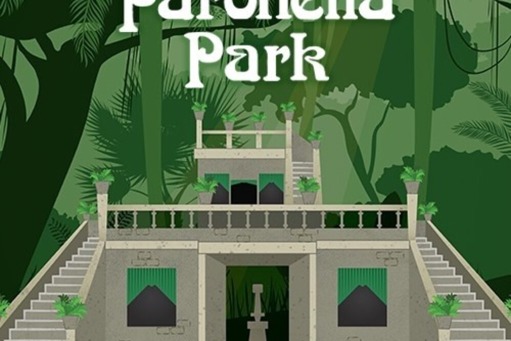
Paronella Park
Originally created in the 1930's by José Paronella, a man with a dream, Paronella Park continues to be enjoyed by visitors from near and far. Jose Paronella’s dream was to build a castle. He chose... a special part of Australia and created Paronella Park. On 6 hectares beside Mena Creek Falls he built his castle, picnic area by the falls, tennis courts, bridges, a tunnel, and wrapped it up in an amazing range of 7, 500 tropical plants and trees. It was opened to the public in 1935. Paronella Park has received multiple Queensland tourism awards, is State and National Heritage listed. And is a national Trust listed property. It is privately owned and operated and Eco accredited. Paronella Park is the site of Queensland’s 1st privately owned hydro electric plant, (1933). The Love Story José Paronella arrived in Australia from Catalonia in Spain, in 1913. For the next 11 years he worked, cutting sugar cane initially, then purchasing, improving, and reselling cane farms. In 1924 he returned to Spain and married Margarita in 1925. The trip back to Australia was their honeymoon. To find out the remaining part of this amazing love story you will have to take the time to experience the magic of Paronella Park…….. Paronella Park is open seven days a week from 9am to 7.30pm except Christmas Day. AVAILABLE TOURS The Dream Continues Tour. A 45 minute guided walk takes the visitor through the highlights of the Park and tells the story of José Paronella’s dreams and vision. Departs every 30 minutes from 9.30am until 4.30pm. The Darkness Falls Tour The Visitor is shown the secrets and delights that are Paronella Park at Night - a special way to extend the Paronella Park Experience. 6.15pm each night. Duration 1 hour approx. Self-guided Botanical Walk A 16 page Listing Booklet containing details of 88 of the Park's flora. The trees are identified throughout the Park. Admission Adult - $57.00 Concession $52.00 Children (5 -15 years) - $32.00 Family Deal (2 adults and 2 children under 15 years) - $168.00 Family Deal (2 adults and 3 children under 15 years) - $178.00 Prices Current as of June 2024. Please contact Paronella Park Direct to confirm pricing and availabilities.
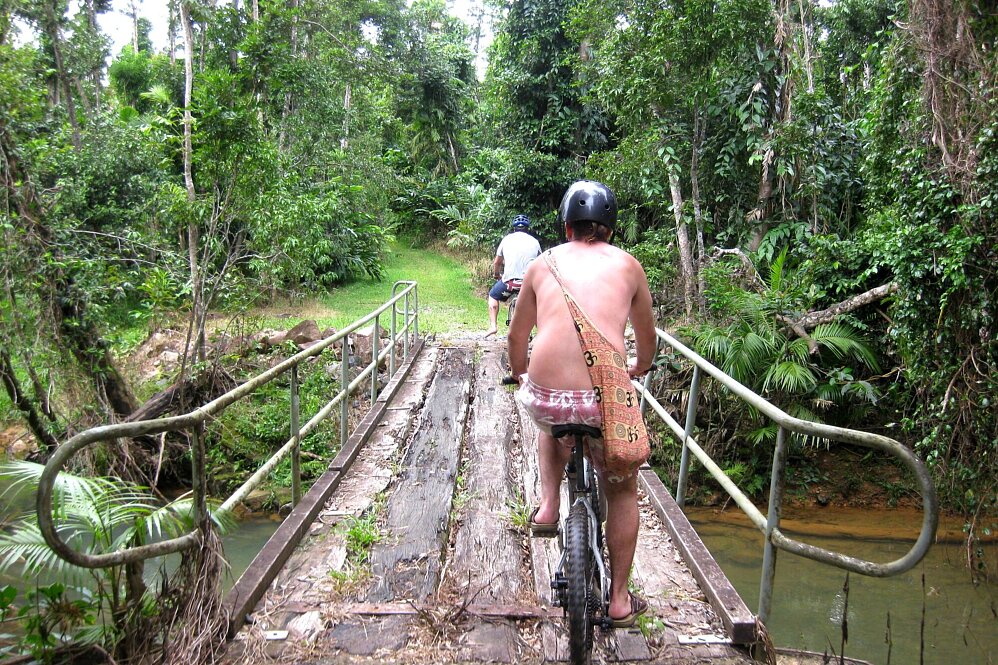
Mission Beach Bike Hire
Mission Beach is a beautiful treasure on the North Queensland coast and the best way to explore this unique area is by bicycle. Smell the flowering native trees and shrubs and find wildlife at a pace you... can enjoy. With 14 kms of golden sands as your bike path with views of Dunk Island, its only a few minutes of pedal power to get from beach to beach. High tide? Not a problem with landscaped bike paths joining Mission Beach to Wongaling Beach and just ask us about some other local short cuts! From family enjoyment or a romantic sunset ride to a patch of uninhabited beach or even for the holiday maker who just needs to keep on top of their fitness regime, bicycles certainly tick all the boxes. Contact us to organize your cycle requirements and they will have your bikes ready for your arrival wherever you stay in Mission Beach. Free Helmets and Bike Locks with every bike. Bicycle Selection: Adult's Bikes *Beach Bike - Perfect for beach riding, get to know the Mission Beaches on these fat tyred bikes. Also ideal for exploring the many forest tracks in the area. *Mountain Bikes - Great for exploring the 14 km strip of road from Bingil Bay to South Mission Beach and the rainforest tracks. *Road Bikes - Quality road bikes to explore the beautiful Mission Beach area and take in the many local sites. Children's Bike *16 Inch Bike *20 Inch Bike *20 Inch Mountain BMX Bike Mission Beach Bicycle Guide Below is an overview of some of the bike track and walks on offer in Mission Beach. This is a guide only, make sure you do your own exploring on two wheels! Remember the best pathway in Mission Beach is the 14 km long golden sandy one!!!! ENJOY!!! Please contact Denis & Sue to confirm pricing: Email: missionbikehire@gmail.com Tel: 0475 405 539
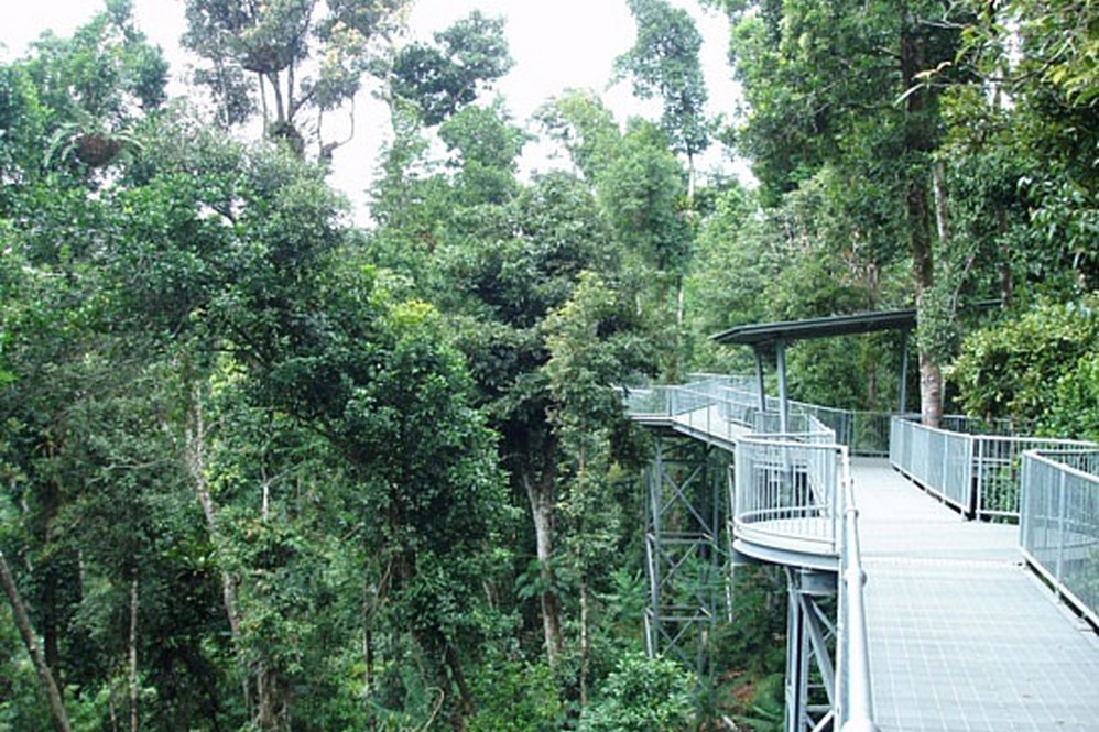
Mamu Rainforest Canopy Walkway
The Mamu rainforest is the homeland of the Ma:Mu Aboriginal people. Many generations of Ma:Mu people have lived here - they have a strong and enduring connection with their rainforest country. The Mamu... walkway allows visitors to explore the rainforest and heritage from the forest floor to the canopy, in comfort and safety. The walkway passes through one of the largest remaining continuous stands of complex vine forest on basalt soils in the Wet Tropics. Enjoy close-up views of rainforest plants, insects and birds, and take in sweeping vistas of World Heritage rainforest landscapes. Information signs tell of the rainforest's complex web of life and the rich culture and history of the area. The walkway features: • a 350m elevated walkway, rising from ground level to 15m high in the canopy of lush tropical rainforest • a 10m cantilever and a 37m high observation tower with two viewing decks, providing spectacular views over the North Johnstone River gorge and surrounding rainforest-clad peaks of the Wet Tropics World Heritage Area • more than 1100m of forest walking tracks, connecting the elevated walkway, cantilever and tower • rest shelters presenting information about the history and heritage of Mamu rainforest. Facts and statistics • About 156 tonnes of hot dipped galvanized steel are in the elevated walkway. • Almost 22, 000 bolts are in the elevated walkway. • About 563 cubic metres of concrete are in tower footings. • More than 900, 000 plastic 2-litre milk bottles are in the recycled plastic decking on walkways. • Steel structures were pre-fabricated off-site in Innisfail and Cairns, pre-assembled on-site then erected with a self-erecting tower crane. • More than 3.5m of rain fell during construction. • The walkway is built to withstand cyclonic winds. • The walkway cost $10 million and took 16 months to build. • Read more about the nature, culture and history of the Mamu Rainforest Canopy Walkway, Wooroonooran National Park. Accessibility The walkway offers a safe and comfortable nature-based experience for all visitors. All facilities and walking tracks except the top viewing deck of the observation tower are accessible for wheelchairs with assistance. Alternative routes suitable for wheelchairs and strollers are provided along the Forest walk (indicated by directional signs). All facilities and walking tracks are accessible for visitors with vision-impairment. Tap rails, hand rails, and tactile directional signs are provided along all tracks and walkways. Braille and large print guides are available from the ticket office. Walking To see all the features of the Mamu Rainforest Canopy Walkway requires a 2.5km return walk and takes at least one hour. Ninety minutes to two hours is recommended to allow for rest stops in the shelters and time to enjoy the scenery. If you have limited time or are unable to walk the entire distance, you may choose to do only part of the walk. Forest walk The Forest walk serves as the access track to the cantilever, elevated walkway and observation tower and provides the opportunity to experience tropical rainforest at ground-level. Alternative routes suitable for wheelchairs and strollers are provided along the Forest walk (indicated by directional signs). This track is suitable for visitors with vision-impairment with tap rails forming a continuous "shoreline" on the left hand side of the track. Seats are provided along the way. Cantilever To the left, just past the first rest shelter, a 40m long elevated walkway rises gently as the ground below drops away steeply, providing visitors with their first chance to experience the rainforest canopy. The viewing platform at the end of the 10m long cantilever offers magnificent views of the river gorge below. Return the way you came to rejoin the Forest walk which continues on to the elevated walkway. Elevated walkway From the second rest shelter, the elevated walkway meanders for 350m through the rainforest canopy. Along the way visitors can view rainforest plants and animals at close quarters and gain tantalising glimpses of the river valley far below. Two small shelters positioned at regular intervals along the walkway provide shade. From these shelters there is the option to leave the elevated walkway and return to the ground-level Forest walk. A third ground-level rest shelter is located at the base of the walkway leaving from the second canopy-level shelter. Observation tower Access to the observation tower is from the fourth ground-level rest shelter at the end of the Forest walk (past the elevated walkway). From here a short elevated walkway leads to the tower's lower viewing deck. The top of the tower is reached by stairway (not wheelchair accessible) and at 37m above ground-level offers spectacular, uninterrupted vistas of World Heritage landscapes. Picnic and day-use areas • Picnic tables are provided near the entrance. • Nearby Gooligans and Henrietta Creek day-use areas have picnic facilities and are accessed from the Palmerston Highway. Admission fees: Prices Current as at December 2022 • Adult: $28 • Child: $17 (4-14 years, children under four are free) • Family: $84 (two adults, two children) • Family: $90 (two adults, three children) • Concession: $24 Combined ticket for Paronella Park and Mamu Tropical Skywalk. Can be used on separate days. Validate at either property. • Adult: $72 • Child: $41.50 (4-14 years, children under four are free) • Family: $212.50 (two adults, two children) • Family: $227 (two adults, three children) • Concession: $64 Prices Current as at December , 2022. Please contact Mission Beach Holidays to confirm pricing.
Local Walking Tracks – Musgravea Track
MUSGRAVEA TRACK (TRACK BETWEEN LICUALA AND LACEY’S CREEK WALKING TRACKS) 6 KM – ONE WAY – APPROX. 2.5 HOURS This longer track is a multi-use track for walkers and mountain-bike riders. It is the... only track in Djiru National Park where bicycles are permitted. This mainly flat track is suitable for dry weather access and requires a medium level of fitness. It follows an old forestry road used in the 1960s and 1970s to haul timber from South Mission Beach to the El Arish timber mill. The track heads north from the car park at the Licuala day-use area and exits on to the El Arish–Mission Beach road about 2 km east of the Lacey Creek day-use area. For safety reasons, the old vehicle bridges have been removed and detours to the two creek crossings have been marked for walkers and cyclists. Bicycles will have to be carried down several steps, through the creek and up several steps at each creek crossing. Creeks in this area are subject to flash flooding and caution should be exercised. The Musgravea track and the Dreaming trail join shortly before the road exit.
Local Walking Tracks – Licuala Fan Palm Walk
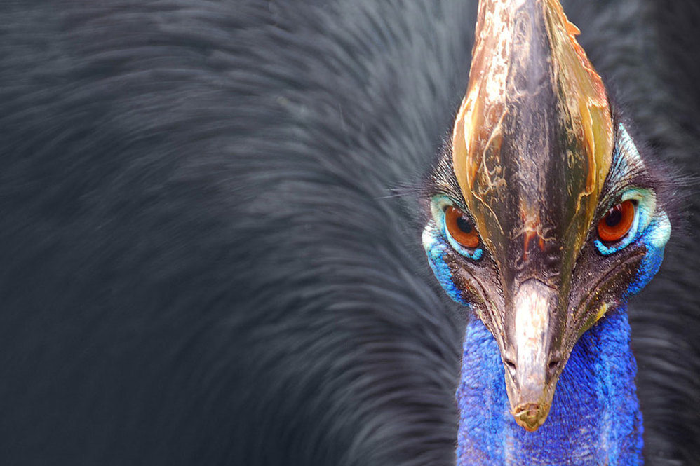
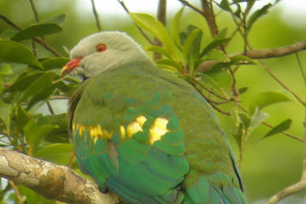
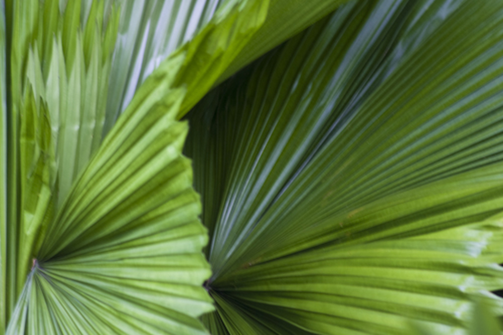
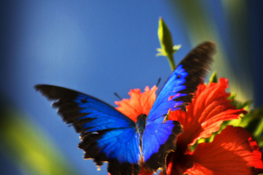
LICUALA FAN PALM WALK 1.2KM - APPROX. 30 MINUTES Licuala Fan Palm Walk is accessed from the Tully –Mission Beach Road, approximately 1km after the South Mission Beach turn off heading towards Tully... from Mission Beach. There is approximately 1 km of unsealed road to the car park. The walk commences from the car park. Take along Morning Tea and sit amidst the lush greenery of Licuala Fan Palms. This is a spectacular walk featuring a 10 -15 metre high canopy of Licuala Fan Palms. Mission Beach has approximately 50% of the remaining Fan Palm Forest in Australia. Their fleshy orange fruit is a favourite food of the elusive cassowary. The walk is a flat easy walk and there are numerous name plaques to ease the curiosity explaining many of the features of the rainforest including cassowaries, vines, epiphytes, strangler figs, ferns, water and nutrient cycling. At the southern end of the loop there is a special 536 metre Fan Palm Boardwalk. The Children’s walk is approximately 350 metres where by following the Cassowary footprints, the children can view a Cassowary nest and eggs. You may see the rare Cassowary, the famous iridescent blue Ulysses Butterfly, Green Tree Frog, Scrub Turkeys or Wallabies. Licuala National Park is on the Mission Beach to Tully road.
Local Walking Tracks – The Ulysses Link and Cutten Brothers’ Walking Tracks
ULYSSES LINK AND THE CUTTEN BROTHERS’ WALKING TRACKS 1.5 KM - 30 MINUTES The Ulysses Link walking track commences on the beachfront at Mission Beach Village. It is named for the brilliant blue Ulysses... butterflies, the 1.5km Ulysses Link Walking Track winds its way along the breathtaking foreshore. The history of Mission Beach has been interwoven along the walk with indigenous and historical stories expressed through mosaics, carvings and ceramic sculptures created by local artists. The track meanders north to Clump Point where it meets up with The Cutten Brothers’ Walking Track. The Cutten Brothers’ Walking Track commemorates the first white settlers who came to Mission Beach area in 1882 and settled at Bingil Bay, where they farmed mangoes, bananas, pineapples, coffee, citrus fruit and coconuts. They also manufactured their own coffee. Produce was shipped south on cargo-boats. The forest on the Cutten Brothers’ Walking Track is known as Complex Mesophyl Lowland Vineforest and is the only surviving remnant left at sea level. This beautiful cool green world is filled with Epiphyte bird nests, Elkhorne ferns, Lianes, Feather leaf tree fern, Cordyline, huge trees with plank buttresses covered in mosses and plants known as Cauliflory. It is the home to the Cassowary, Scrub Turkey, parrots, wallabies the shy Betong and many small mammals and reptiles. It is also the habitat of dozens of different species of birds and butterflies.
Local Walking Tracks – Dunk Island
The gently-rising hills of the Family Islands contrast with the jagged and lofty profile of Hinchinbrook Island, which dominates the southern horizon. Dunk Island, like the other Family Islands, is cloaked... in a mosaic of dense rainforest in protected gullies and wet slopes. Eucalypt forest, with an understorey of palms, occurs on drier more exposed ridges. The Family Islands lie within the traditional sea country of the Bandjin and Djiru Aboriginal peoples, who, for tens of thousands of years, have collected, gathered and hunted the rich marine and island resources for food and materials. Today they retain a strong connection to these islands. Lieutenant James Cook named Dunk Island in 1770 but it is best known from the writings of the 'beachcomber', E.J. Banfield. Living on Dunk Island from 1897 until 1923, Banfield wrote four books about the island's natural and cultural history. Dunk Island offers a range of walking tracks which allow exploration of the island's famed natural history and rediscovery of its fascinating past. Take an easy stroll through the rainforest to a secluded beach or embark on a climb to the summit of Mount Kootaloo. (The distances and times below are calculated for walks beginning on Dunk Island Spit). MUGGY MUGGY BEACH — 3 km return (70 mins) Grade: easy From the spit, walk to the north-east end of the beach to the start of the walking tracks. This pleasant walk winds through rainforest, coastal woodland, and mangroves before arriving at Muggy Muggy Beach. At this picturesque sandy cove, sheltered behind a rainforest clad headland, enjoy a swim and snorkel before returning along the same track. Access to this walking track may be affected by tidal influences at certain times. MOUNT KOOTALOO — 7 km return (3 hrs) Grade: moderate From the spit, walk to the north-east end of the beach to the start of the walking tracks. This more strenuous walk winds up a steep track to the 271 m summit. Cyclone-damaged rainforest on the lower slopes allows glimpses over the island and reefs as the track ascends. On the upper slopes, the forest opens out and eucalypts emerge through the canopy. Near the summit, a short branching track leads to a lookout, which offers spectacular views over the Family Islands and nearby mainland. Near the lookout, the remains of No. 27 Radar Station, built during World War II, are slowly being reclaimed by the rainforest. The track continues around the summit, rejoining the main track and returning to the beach. Access to this walking track may be affected by tidal influences at certain times. ISLAND CIRCUIT - 9.2 kilometres (3 hrs) Grade: moderate From the spit, walk to the north-east end of the beach to the start of the walking tracks. Mt Kootaloo, you’ll pass through the magical Palm Valley and then onto Coconut Beach. Not for the faint hearted, this challenging walk will introduce you to Dunk Island’s lush green rainforest where you are likely to encounter the many different species of birdlife. The islands support many species of birds, insects, reptiles and mammals. The brilliant blue Ulysses butterfly has become a symbol for Dunk Island. The fringing reefs surrounding each of the islands are home to a diversity of reef life. Extensive seagrass beds lie between the islands providing important feeding grounds for sea turtles and dugong. Upon finishing your walks, you can unpack the picnic in the Day Use Area where you will find toilet and BBQ facilities and spend the rest of the day relaxing under the shade of the palm trees. Access to Dunk Island via private boat, hire boat, Mission Beach Dunk Island Water Taxi or charter boat.
Local Walking Tracks – Lacey Creek Walk
LACEY'S CREEK WALK 1.5KM - APPROX. 45 MINUTES Lacey’s Creek Walk is approximately 7.5km from Mission Beach Village along the Mission Beach – El-Arish Road. Lacey’s Creek offers you crystal clear... waters running over pebble stones. There are picnic tables, BBQ’s and toilet facilities for your convenience. This walk is best appreciated when walked in an anti-clockwise direction. Starting from the Cassowary Information Shelter, here you can learn about cassowaries, which are frequently seen in the area. Cassowaries rely on the rainforest for their food and shelter. The fruit of over 230 rainforest plants provides them with a large menu to choose from. Signs identify a variety of the food plants growing near the cassowary information shelter. The track passes through rainforest and exits at the picnic area near the car park. Signs along the track provide information about the evolution of various plants and animals. About half way round, a viewing platform allows walkers to peer into a calm pool of Lacey Creek and spot saw-shelled turtles and fish of various types. Signs help with identification. Cassowaries are often spied at Lacey’s Creek.